2019
2019-11-12
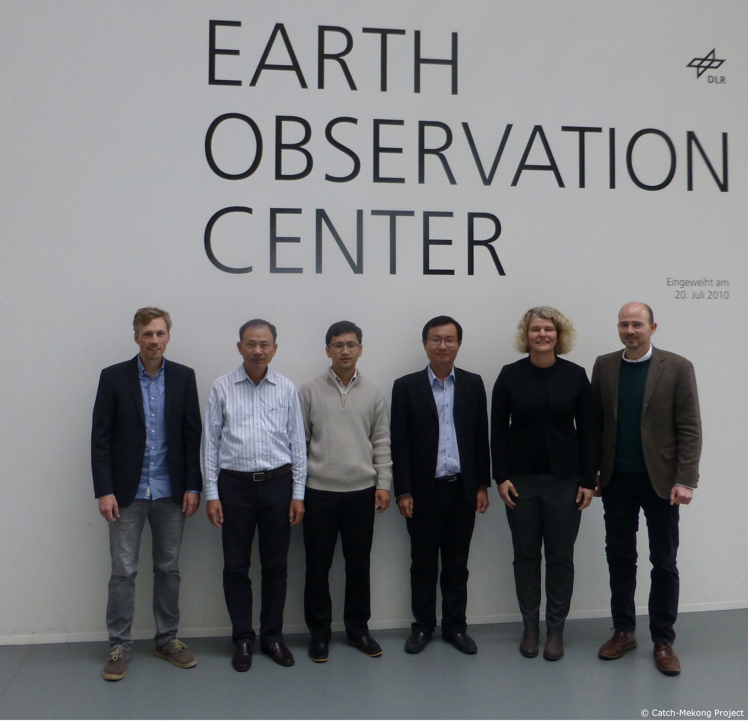
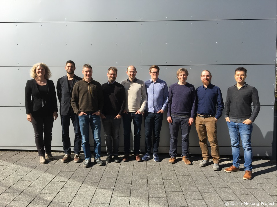
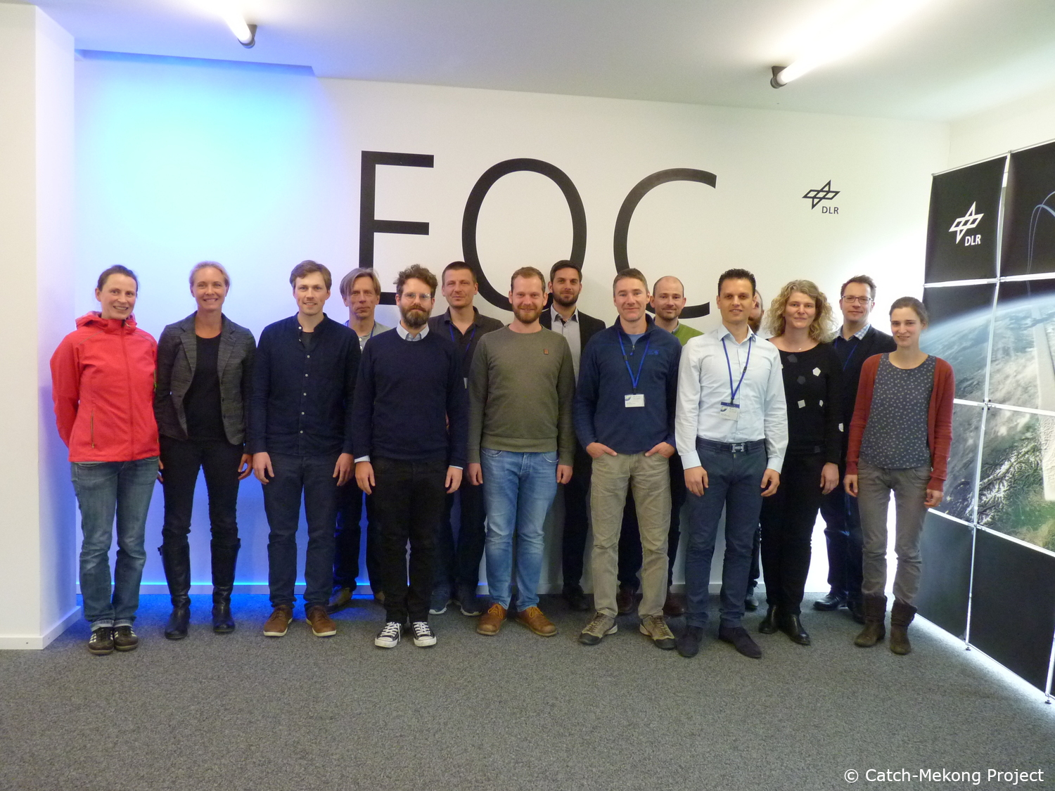
Catch-Mekong Technical Meeting at DLR
On November 12, 2019, DLR welcomed the Vietnamese project partners from WACC and STAC as well as SEBA Hydrometry from the German side for a technical meeting at the Earth Observation Center (EOC), German Aerospace Center (DLR) in Oberpfaffenhofen, Germany. DLR presented the final Mekong Knowledge Hub and handed over the technical documentation to the Vietnamese project leader. SEBA Hydrometry and the WACC signed the official handover document for the measurement equipment installed in the Mekong Delta.
2019-08-05
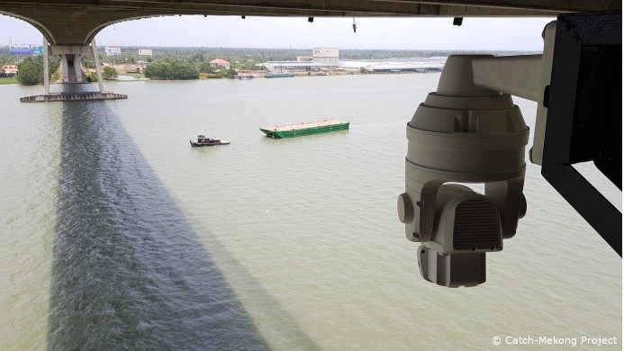
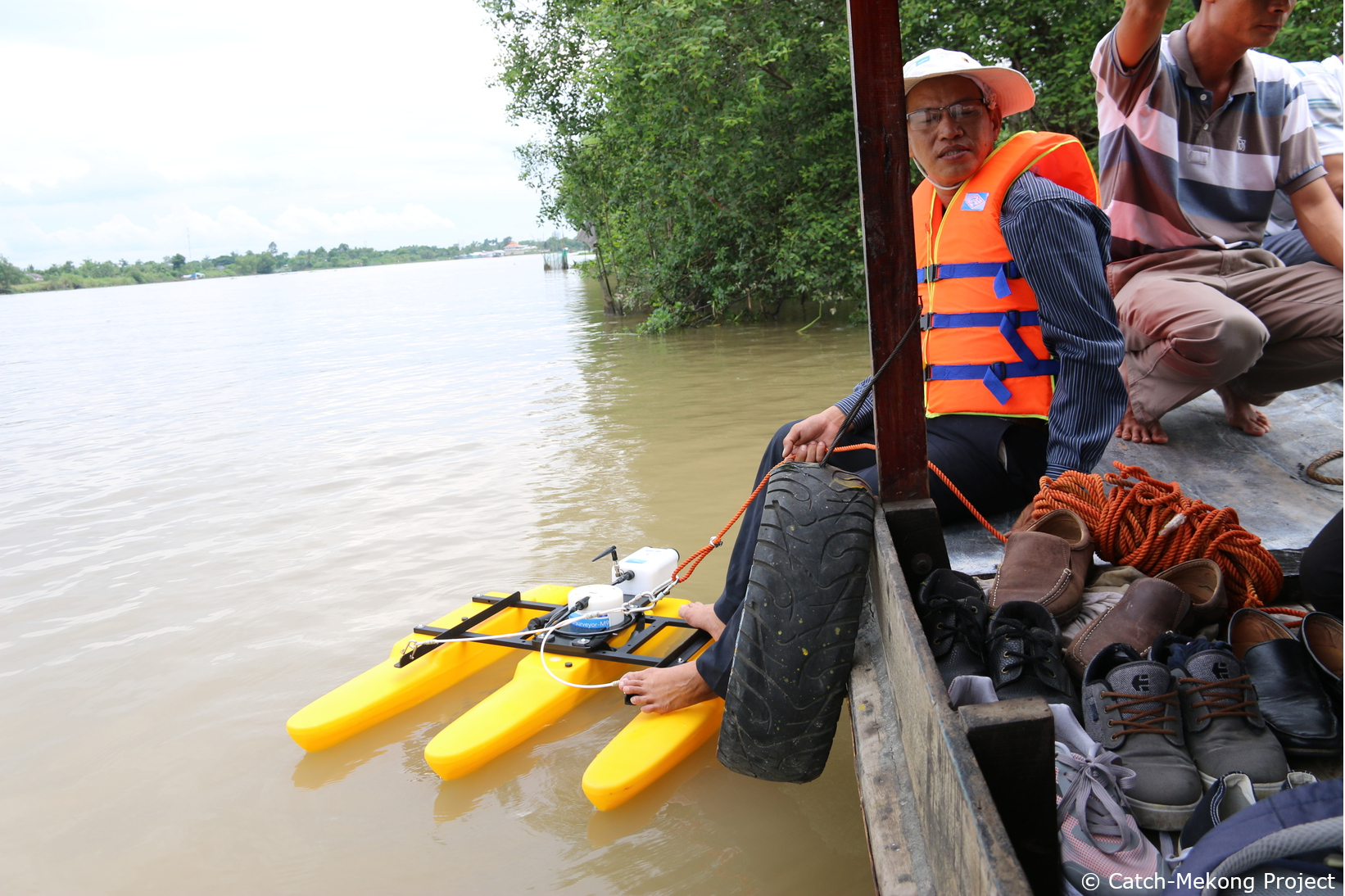
Gallery: Discharge Measurements at the Mekong Delta using SEBA-DischargeKeeper technology
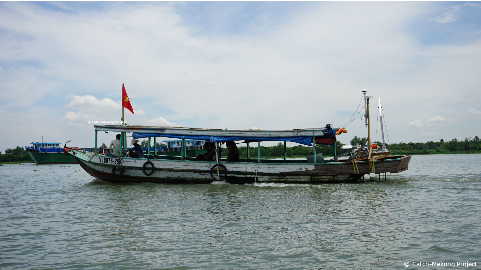
Since May 2019 the Catch-Mekong Partner SEBA Hydrometrie GmbH & Co. KG measures the flow velocity at the Mekong delta as feasibility study for continuous and non-intrusive discharge measurements of large rivers. The measurements are performed at the My Thuan bridge, which spans a river arm about 600 meters wide. The flow velocity is measured using the newly developed camera-based discharge system – the DischargeKeeper.
The components of the DischargeKeeper are a camera with remote pan, tilt and zoom functions with an in-built infrared beamer, a processing unit, a modem for data transmission of the videos recorded every 10 minutes. ADCP measurements are used for comparison. The expected outcomes will demonstrate the potential of the DischargeKeeper technology to deliver results within accuracy specifications for such large scales.
2019-07-01
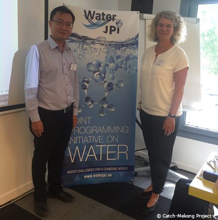
Invitation to the “JPI Water” Workshop in Paris
The Federal Ministry of Education and Research (BMBF) is involved in the European initiative “Water Challenges for a Changing World” (Joint Programming Initiative, JPI Water). For the workshop “Towards a Common Strategy for International Cooperation”, JPI Water invited the Catch-Mekong project leader to report on the Vietnamese perspective of international cooperation, especially from Catch-Mekong project. The workshop took place on 25 June 2019 in Paris and brought together 40 scientists from the EU, India, South Africa, Brazil, China and Vietnam involved in water related research. The participants shared their experiences in international cooperation, discussed the challenges of cooperation and possible solutions for the further development of future programs.
2019-04-20
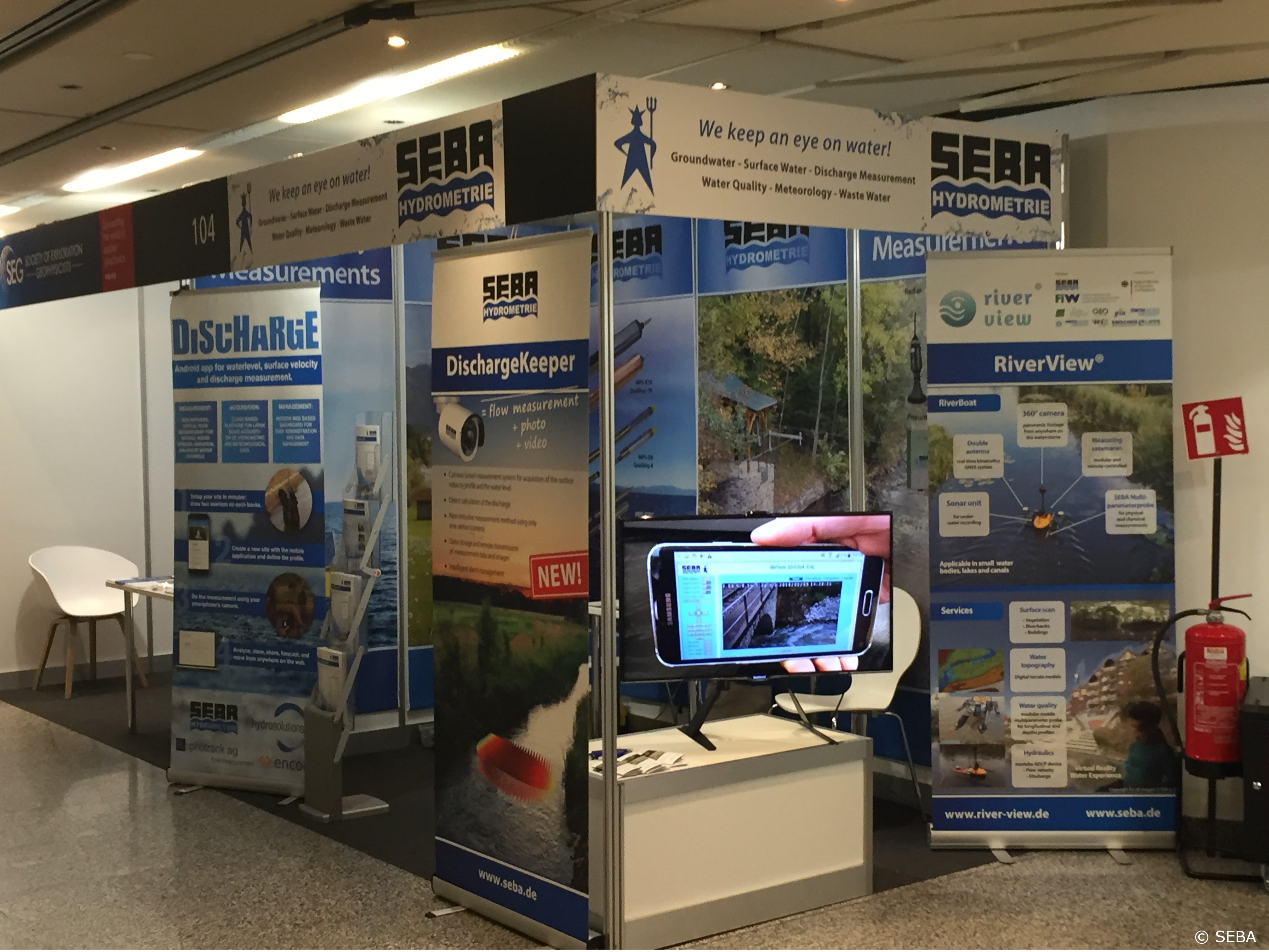
Catch-Mekong Partner SEBA at the EGU General Assembly 2019 in Vienna 8.-12. April
SEBA was successfully showed up for the first time with its own stand at the largest geo- and environmental science conference in Europe the EGU General Assembly in Vienna. The conference was attended by more than 16,000 scientists from 113 countries. SEBA experts presented two poster contributions on the topics of multilevel salinity monitoring in groundwater and camera-based discharge measurements in rivers and channels.
2019-04-05
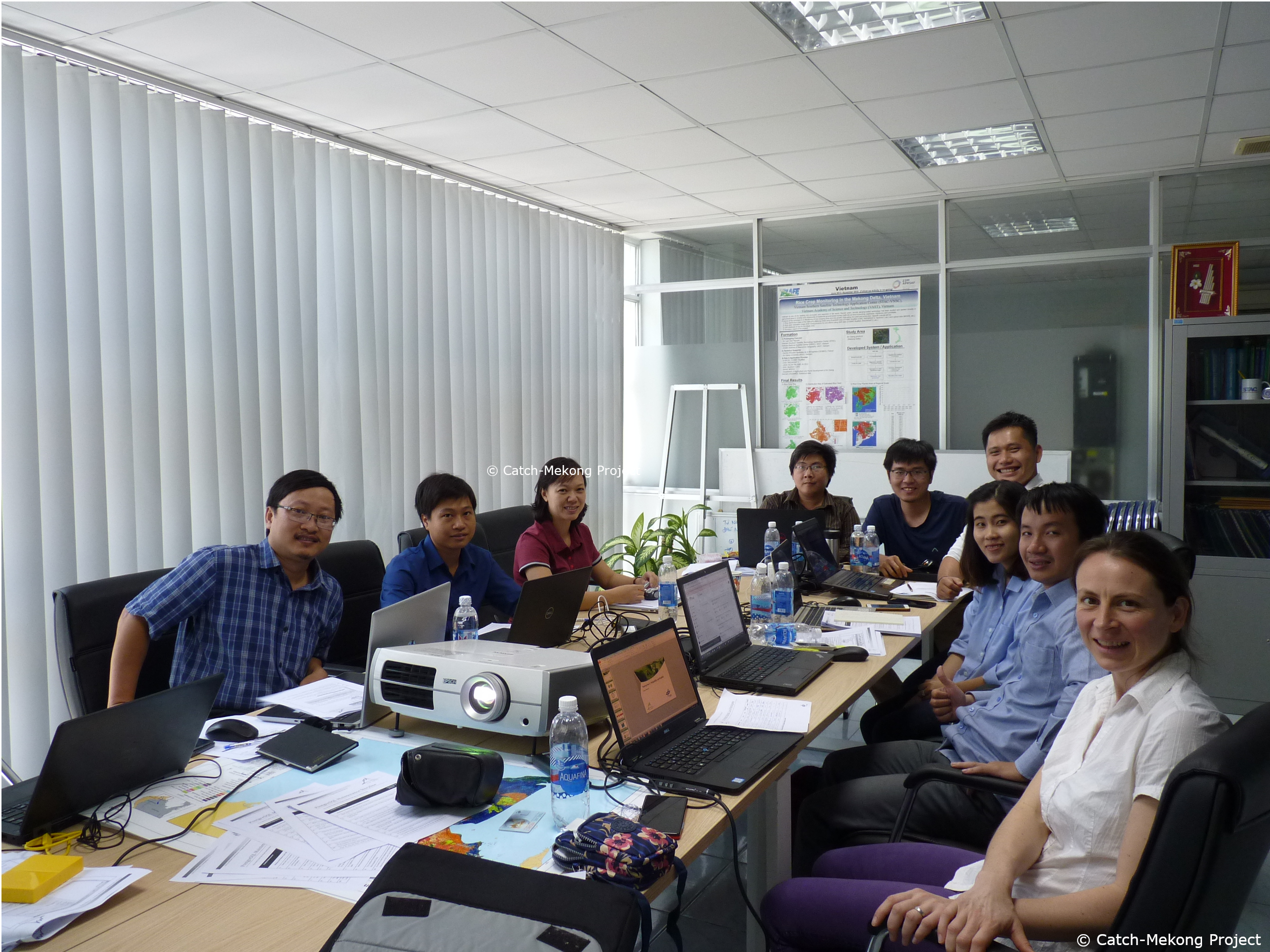
IT Workshop on data handling and information system management, 1-2 April 2019, Ho Chi Minh City
DLR conducted a technical hands-on training for the hosting and maintenance of the Mekong Knowledge Hub together with the Center of Water Management and Climate Change (WACC) of the Vietnam National University (VNU). In a two day workshop, the participants learnt and practiced advanced IT technics such as environment virtualization, web services handling, and system configuration. Furthermore, the participants gained experiences on database management with a focus on geodata handling as well as data querying based on complex SQL statements.
2019-03-24
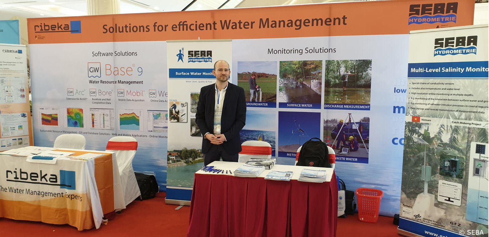
Catch-Mekong Partner SEBA presenting at the Vietnam wAter Cooperation Initiative (VACI) and Vietnam International Water Week in Hanoi 21.-22. March 2019
On the 21st and 22nd of March, this year’s VACI took place together with the Vietnam International Water Week in Hanoi. Nearly one thousand keynote speakers, participants and visitors from 30 countries attended the conference. At the accompanying exhibition, companies and organizations presented their work areas - including Catch-Mekong Partner SEBA Hydrometrie, who presented project results on hydrometric monitoring in the Mekong Delta.
2019-02-26
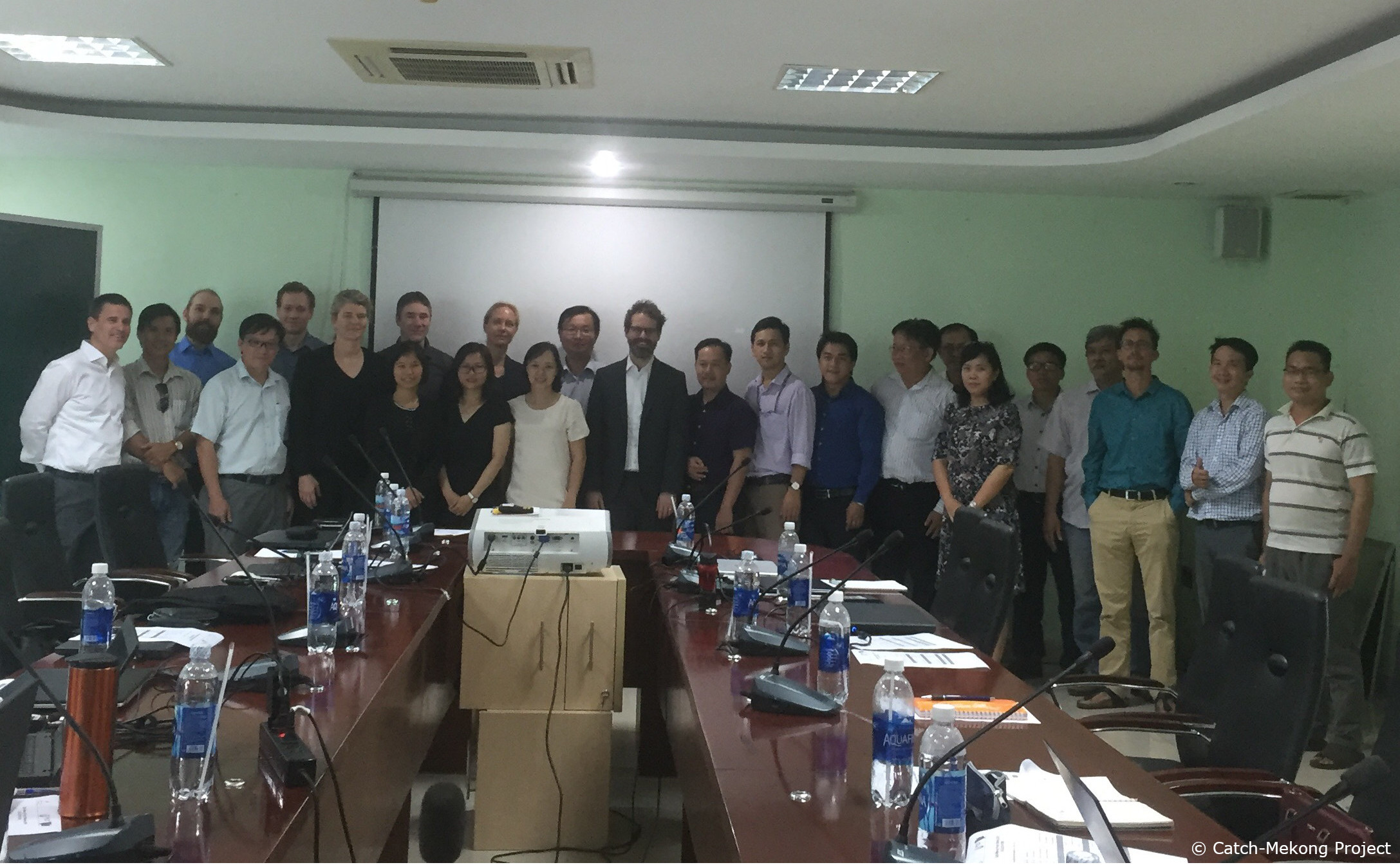
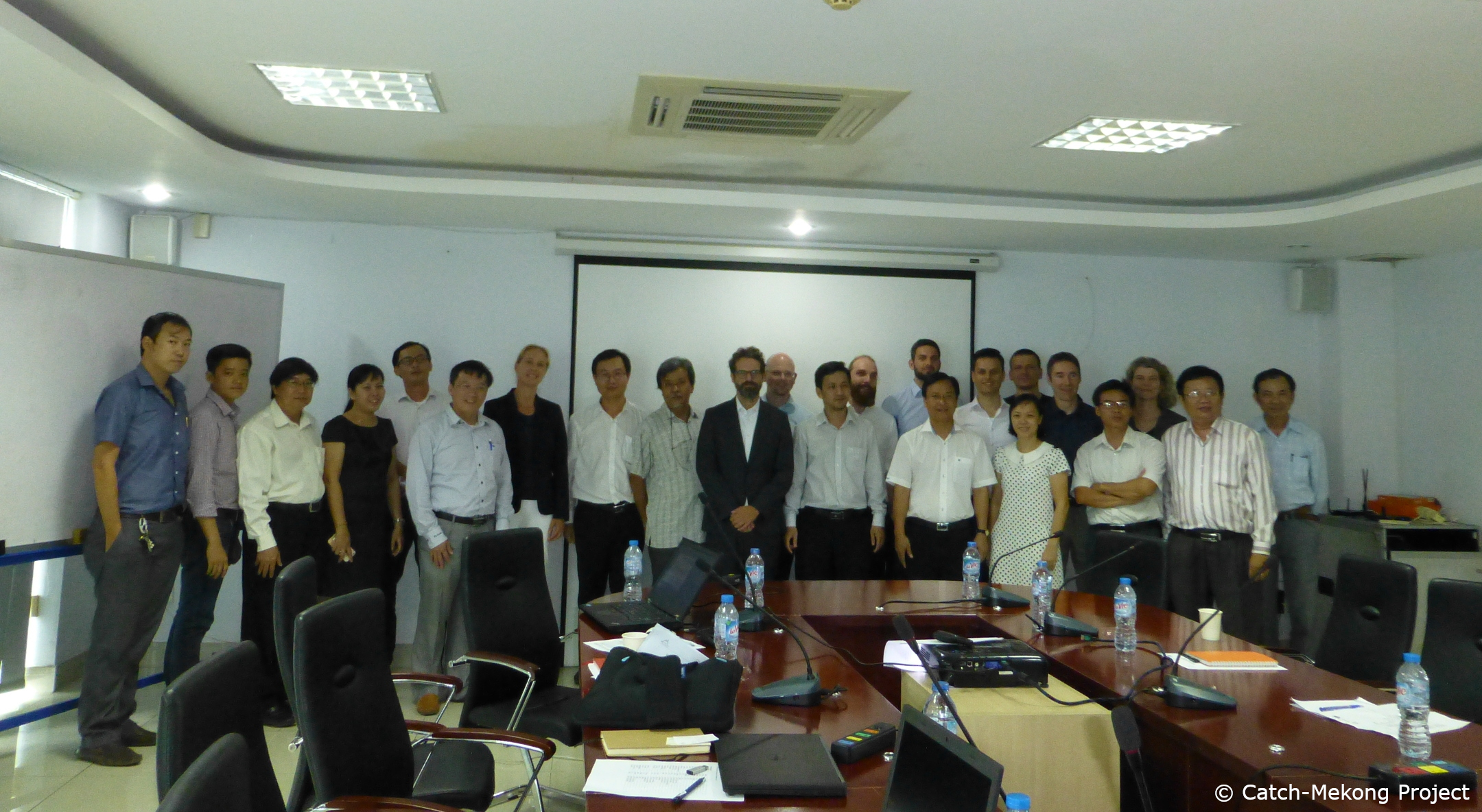
Catch-Mekong Project Meeting held in Ho Chi Minh City
On February 26, 2019 the Vietnamese and German project partners held a joint project meeting at the Southern Satellite Technology Application Center (STAC) in Ho Chi Minh City, Vietnam organized by the Center for Water Management and Climate Change (WACC) of the Vietnam National University – Ho Chi Minh City (VNU-HCM). All project partners met to present results of the measurement campaigns in the Mekong Delta which were organized by the WACC and conducted in close cooperation with GFZ - German Research Center for Geoscience, LU-FI -Ludwig-Franzius-Institute for Hydraulic, Waterways and Coastal Engineering, and SEBA Hydrometrie GmbH since the kick off meeting in July 2017. In addition, the project results for Earth observation analyses were presented by the project partners from STAC, EOMAP GmbH and the remote sensing unit of the University of Wurzburg. The German Aerospace Center (DLR) reported on the progress made in the development of the Mekong Knowledge Hub.
2018
2018-10-30
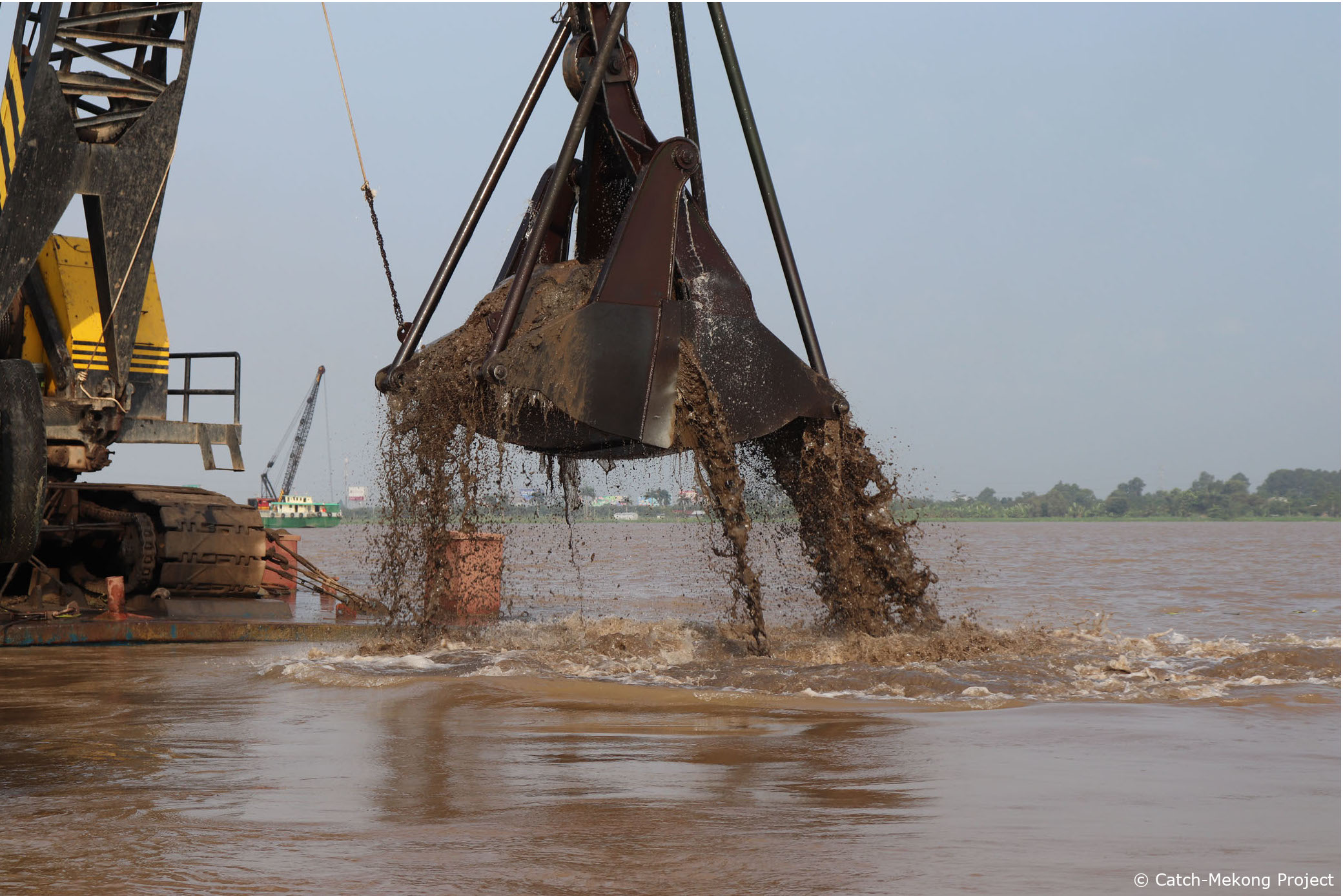
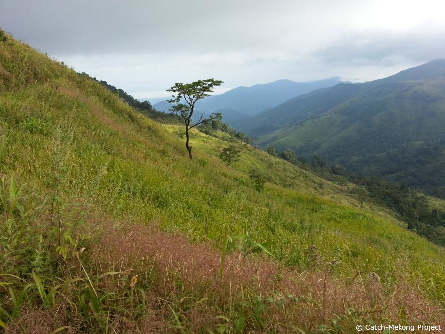
Gallery: Field survey during high-discharge season near the city of Vinh Long
Measurements of hydro-, morpho- and sedimentological parameters near the city of Vinh Long were carried out by the Ludwig-Franzius-Institute (LuFI) during the high-discharge season in September / October 2018. In order to compare results between the low- and high-discharge seasons, the same set-up of sensors was used for both surveys (multibeam echosounder, ADCP, LISST and CTD). Maximum measured discharges in autumn were about twice as high as in spring, leading to a noticeably different hydro- and sedimentological regime within the Mekong River. Amongst other interesting aspects, the second in-situ campaign concentrated on the morphological development of certain focus areas (dune fields, dredge pits), which were identified during the low-discharge season.
2018-10-04
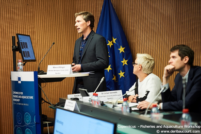
Catch-Mekong Project presented at Copernicus for Aquaculture and Fisheries Workshop
DLR presented the Catch-Mekong project work related to remote sensing analysis of aquaculture mapping and production estimation in the Mekong Delta at the first workshop of the European Commission on Copernicus for Aquaculture and Fisheries on October 2, 2018 in Brussels. International experts on satellite remote sensing and terrestrial monitoring of marine and coastal resources discussed on future integration of available new technologies for coastal management, mapping, and monitoring including EO technologies such as free and open Sentinel satellite data.
2018-09-03
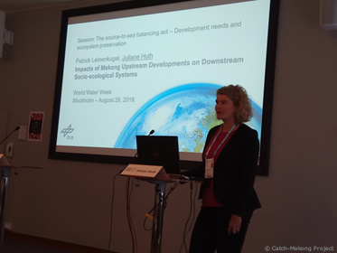
Project Presentation at the Stockholm World Water Week 2018
On August 29, 2018 a presentation was given at the World Water Week in Stockholm to represent the Catch Mekong project on one of the largest get-togethers of the international community on global water issues. The Future Earth Coast, a partnership for the support of a development towards global sustainability, that includes researchers, funders and users of knowledge, initiated the session “Source-to-Sea Balancing Act – Development and Ecosystem Needs“ where the presentation took place.
2018-08-02
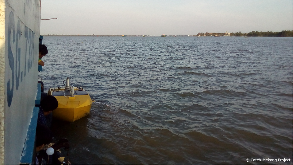
ADCP buoy operational on the Mekong
GFZ developed a river buoy equipped for constant monitoring of velocity profiles and suspended sediment concentrations by a downward looking ADCP. The buoy was shipped to Vietnam and moored next to the hydrographic monitoring vessel at My Thuan bridge near Vinh Long in the Mekong (Tien) river beginning of March. It operates autonomously and records the data at 15 minute intervals. The data are automatically transferred to GFZ for storing and processing. The aim of the buoy is to test its capability of permanent flow velocity, discharge, and suspended sediment monitoring in comparison to the operational manual monitoring. If successful, the buoy could provide a low cost addition to the manned monitoring sites at other location in the Mekong Delta.
2018-05-24
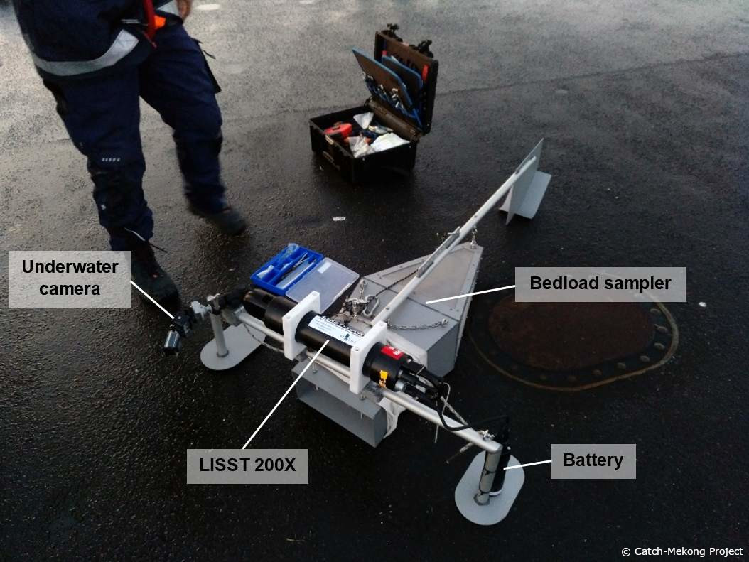
Measurements of hydro-, morpho- and sedimentological parameters near Vinh Long
In April / May 2018, a first extended field survey within the Mekong River, near the city of Vinh Long, was conducted by the Ludwig-Franzius-Institute (LuFI). During the in-situ campaign, the local bathymetry as well as several hydrological and sedimentological parameters were acquired for this year’s low-discharge season. The bathymetry was measured via multibeam echosounder, while an ADCP and LISST-probe were used to measure current velocities, respectively the grain sizes of sediments within the water column. Furthermore, a bedload sampler was used to get information about the bedload transport at hand.
A second field campaign is scheduled for autumn 2018, in order to acquire datasets for this year’s high discharge season.
2018-03-08
Annual Project Meeting held at German Aerospace Center
The German partners of the Catch-Mekong project met on March 8 for the Annual Meeting at the German Aerospace Center (DLR) in Oberpfaffenhofen near Munich. All project partners presented their recent research results. Field campaign plans for 2018 were discussed and coordinated. The time schedule for the envisaged activities in the Mekong Delta was set up.
2018-01-01
Processing and analysis of available hydrological and topographic/bathymetric datasets
For the set-up of hydromorphological numerical models of the Mekong River, datasets of hydrological parameters (discharge, water level) and topography/bathymetry (see Figure 1) have been collected, processed and analyzed by the Ludwig-Franzius-Institute (LuFI).
Existing datasets by German and Vietnamese project partners were therefore supplemented by available datasets by the Mekong River Commission (MRC). The numerical models, which will focus on a river section of approximately 20 km upstream of My Thuan Bridge, are based on the software tool Delft3D. Additional datasets for the calibration and validation of the numerical models will be collected during two in-situ campaigns, which are scheduled for spring and autumn 2018.
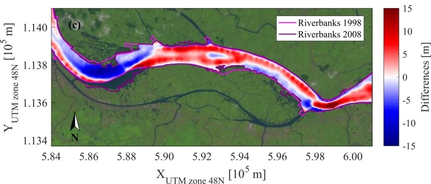
Figure 1: Bathymetric evolution near My Thuan Bridge. (a) Bathymetry 1998, (b) bathymetry 2008, (c) bathymetric differences between 1998 and 2008. Landsat images show the river course for January 9th, 1998, respectively February 8th, 2008. Source of bathymetric datasets: Mekong River Commission.
2017
2017-12-28
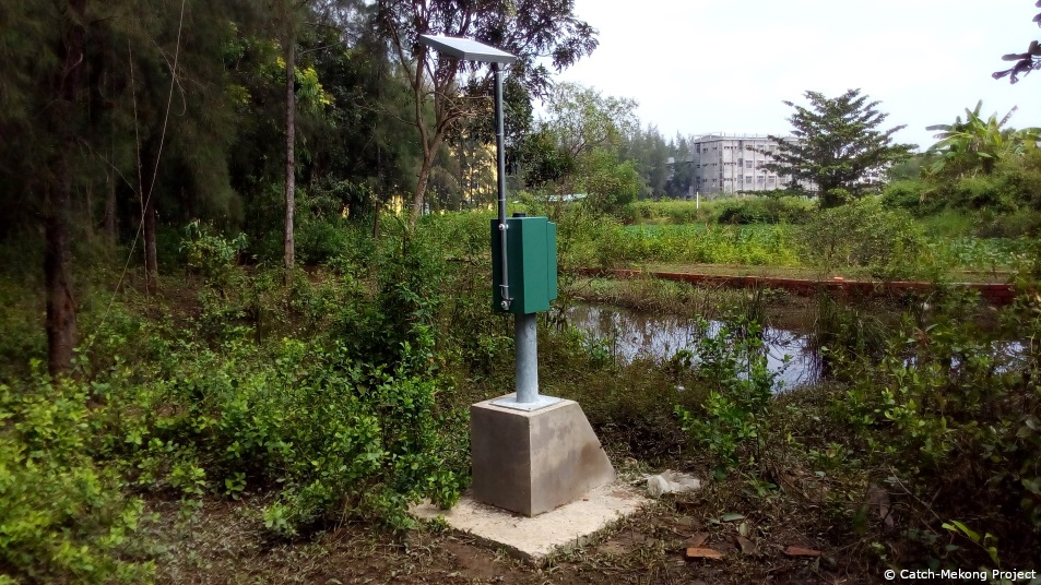
Installation of Ground Water Measurement Stations in Tra Vinh
SEBA Hydrometry developed ground water measurement (GWM) stations for the Mekong Delta. In December 2017 colleagues from SEBA Hydrometry and GFZ Potsdam travelled to Tra Vinh to install 8 GWM stations on the campus of Tra Vinh University � see picture. The measurement stations are equipped with water level sensors and multi-level conductivity technology. Remote data transmission technology has been put into operation and has been tested since January 2018.
2017-11-25
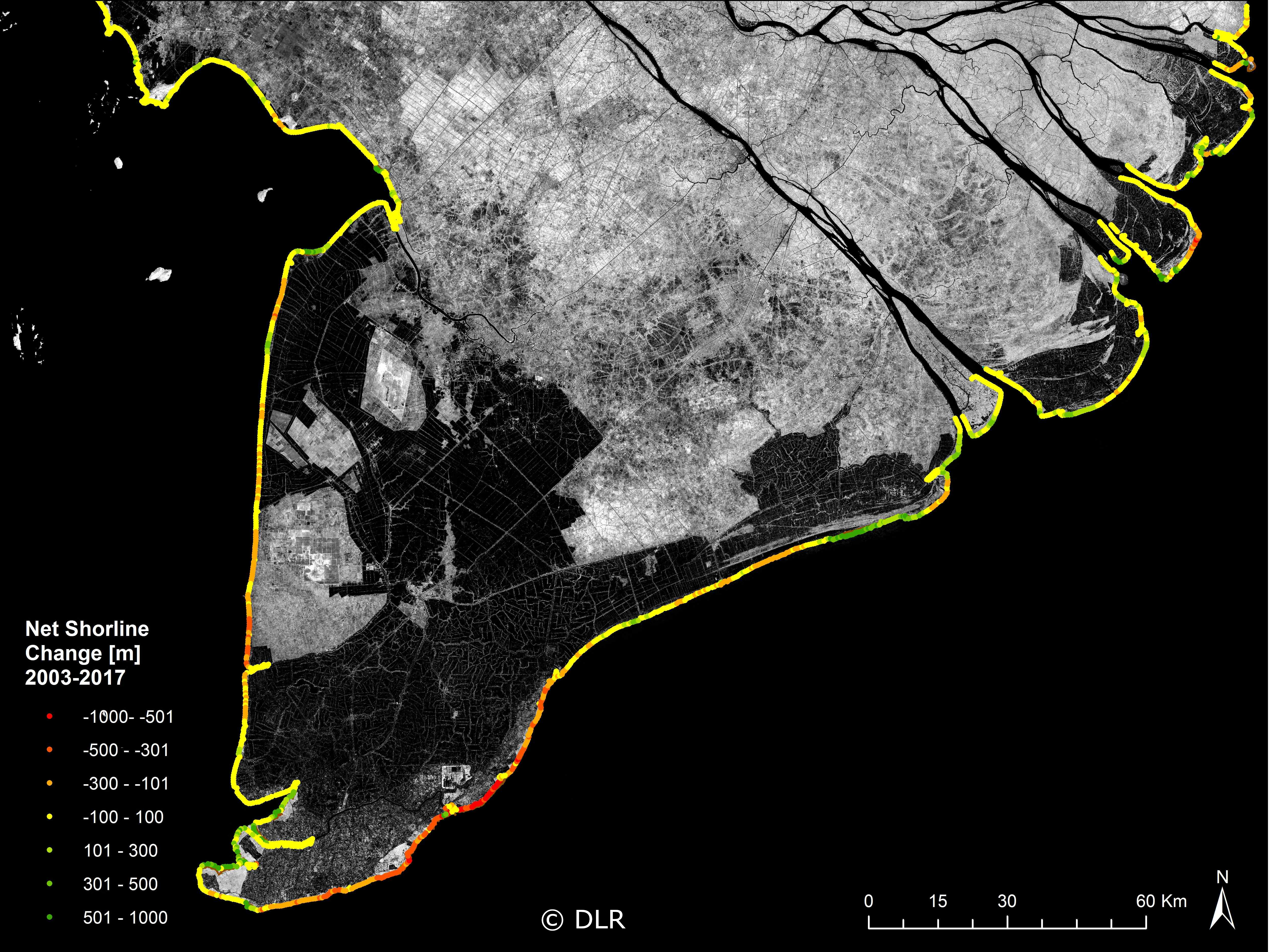
Long-term coastal morphological changes quantified for the entire Mekong Delta
Scientists from University Würzburg recently evaluated long-term coastal morphological changes for the entire Mekong Delta in Vietnam. On the basis of SPOT-5 satellite images from 2003 and Sentinel-2 data from 2017, shoreline erosion and land loss as well as accretion processes through sedimentation were quantified every 500m for the entire coastline of the Delta.
As can be seen from the figure, particularly along the south eastern and south western coastline of Ca Mau province erosion rates are very high resulting in land losses of up to 750 meters within the last 15 years.
2017-10-15
Test measurements within the Jade Bay, Germany
In order to be able to measure bedload transport rates within the Mekong River, a bedload sampler has been manufactured by the Ludwig-Franzius-Institute (LuFI).
The bedload sampler, which is directly placed on the riverbed, can be combined with additional measuring devices (i.e. LISST probe for sediment concentrations within the water column). First in-situ measurements with the bedload sampler were performed within the Jade Bay (Germany), since the existing boundary conditions (water depths, current velocities, sediment properties) are comparable to the Mekong River near My Thuan Bridge, where two field campaigns will be conducted in spring and autumn 2018.
2017-09-15
Sentinel-2 satellite data for the Mekong Delta
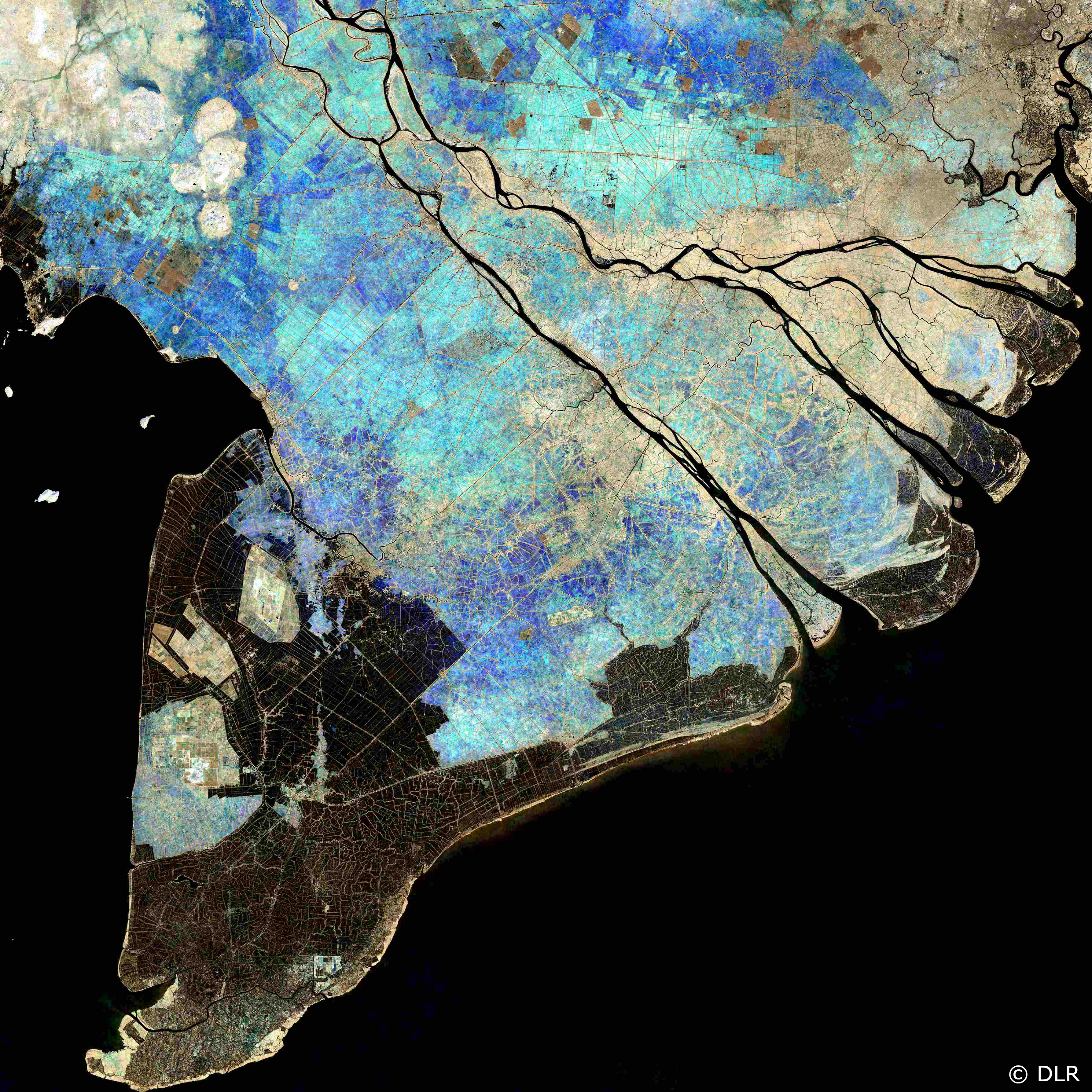
Scientists from the German Aerospace Center (DLR) together with colleagues from the University Würzburg processed terabytes of high resolution optical and radar satellite images to identify and understand natural and human-related processes in the Mekong Delta. Thanks to their high temporal and spatial resolution, the new Sentinel-1 and Sentinel-2 satellites provide an ideal data basis for this effort. The false-colour composite image of the Mekong Delta shown in the figure below is based on a total of 475 Sentinel-2 Level 1C tiles that were recorded over a period of two years. In the three colour channels the image combines a statistical assessment for all recordings, in this case the lowest, mean and highest annual reflection values in near-infrared (NIR).
This approach allows, for example, the detection of detailed spatio-temperal patterns in the delta’s natural flood and rice cultivation cycles. Dark areas are covered year-round with water, light ones are free of water. Coloured areas are temporarily flooded, whereby dark blue surfaces are locations where two rice crops are grown each year and thus covered with water for a longer period than are the turquoise coloured areas where there are three rice crop cycles per year.
2017-08-02
Beginning of Landsat time series processing for the Mekong Basin
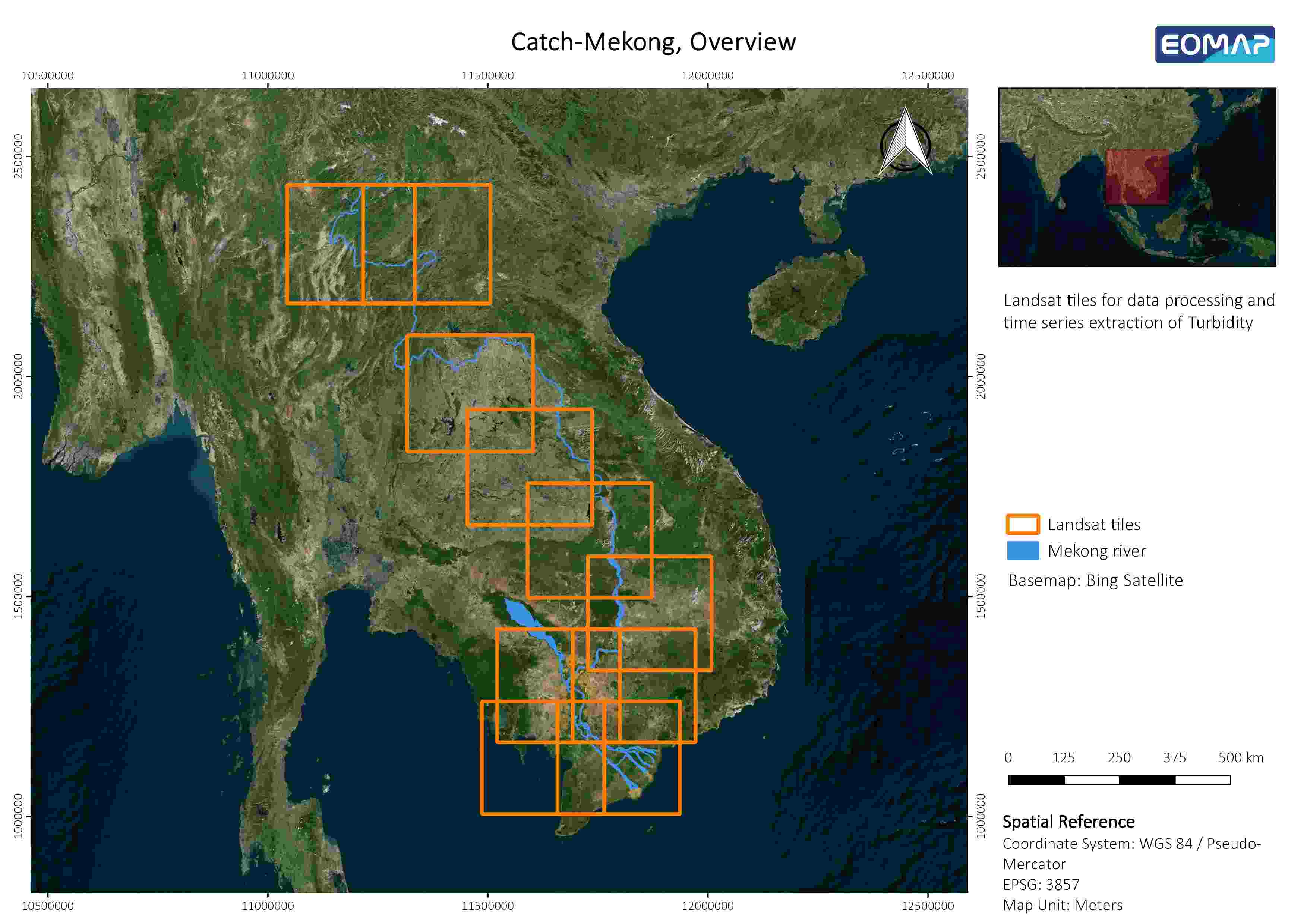
The Catch-Mekong partner EOMAP started with the processing of the USGS Landsat data archive for the extraction of time series information about the sediment loads of the Mekong river.
For that region, it reaches back until 1987. As main regions of interest, the mid- and downstream sections of the Mekong river have been defined, starting at the border between China, Myanmar and Laos and running down to the delta in Vietnam. Due to the huge amounts of satellite records for the timespan over the last 30 years, it was agreed to use only data from the Landsat tiles pictured in the overview below (orange). Since remote sensing acquirements in this region are often limited due to clouds and haze, it is expected to get approximately 10 high quality measurements of Total Suspended Matter per year, which will then serve as calibration data for further hydrological modelling done by the German Research Center for Geoscience, GFZ.
2017-07-31
Installation of monitoring stations for salt water intrusion in groundwater started in Tra Vinh
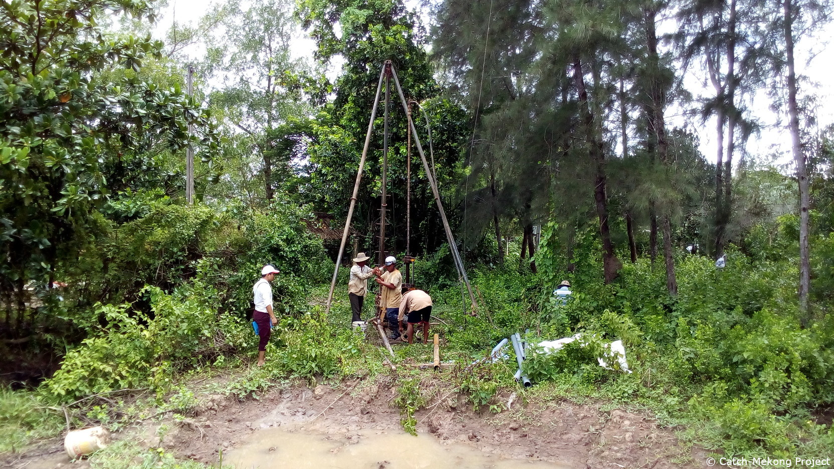
A team of scientists from Tra Vinh university, the German Research Center for Geoscience GFZ, the German company SEBA and the Center for Water Management and Climate Change (WACC) started the installation of a monitoring network for salt water intrusion in the shallow groundwater aquifer.
Two test sites were selected in Tra Vinh city district showing distinct hydrogeological features: a test site with the clay dominated soils typical for the Southern part of the Mekong delta, and another site featuring sandy paleo-dunes located close to the Mekong river. The monitoring network consists of 8 groundwater observation wells, each recording conductivity in three different depths, 3 water quality monitoring stations in the channels surrounding the test sites, and 2 weather stations. All stations are equipped with remote data transfer for online data control and are expected to be fully operational in September.
2017-07-30
First test measurements near Vinh Long
On July 11th and 12th first test measurements were conducted on the Mekong River at a focus area near Vinh Long by scientists of the Center for Water Management and Climate Change (WACC) and the Ludwig-Franzius-Institute (LuFI). The survey included measurements of current velocities and water depths at selected transects. The measurements serve as reference for the planning of an extended field campaign by the LuFI, which is going to take place in autumn 2017, with the aim of getting better insight into the local sediment transport and river morphology during high discharge season. Furthermore, collected datasets will be used for the set-up and calibration of hydro-morphodynamic numerical models.
2017-07-25
Catch-Mekong Kick-Off Meeting held in Ho Chi Minh City
All Vietnamese and German partners of the Catch-Mekong initiative met for the official Kick-Off meeting of the project organized by the Center for Water Management and Climate Change, WACC, of the Vietnam National University, VNU, in Ho Chi Minh City on July 10th.
All partners presented the work they will contribute to the individual research topics and work packages. Furthermore, the focus areas for hydrological field measurements were defined and future cooperation issues were discussed. The Kick-Off Meeting was followed by a joint trip of Vietnamese and German Partners to the Mekong Delta to visit the focus areas for first field measurements and installation of equipment.
2017-04-23
First technical project meeting of the German consortium at DLR
The German partners of the Catch-Mekong initiative met for a first technical discussion at the Earth Observation Center (EOC), at the German Aerospace Center (DLR), in Oberpfaffenhofen near Munich. All partners presented their research objectives and their planned working tasks. The timeframe for the envisaged activities were outlined and the time schedule for joint field campaigns in the Mekong Delta was set up.
2015

2014
2014-06-18
First Ministerial visit to project focus region Tonle Sap lake
At the very beginning of the CATCH MEKONG project a delegation from German Federal Ministry of Education and Research BMBF visited one of the focus project regions - the Tonle Sap lake in Cambodia. A workshop jointly organized by German Aerospace Center, Royal University of Phnom Penh, and Southern Institute of Water Resource Research introduced the challenges the region is facing, as well as the specific research topics that will be focused on in this study region of the project. Later, a field excursion on the Tonle Sap lake gave an understanding of the above mentioned challenges regarding annual flood pulse, protection and sustainable management of natural resources such as water, forest, and fish e.g. to ensure food security for the local population, etc.

2013
2013-05-10
Mekong Environmental Symposium 2013 in Ho Chi Minh City
The Mekong Environmental Symposium 2013 in Ho Chi Minh City was a full success. On the first day of the symposium over 400 stakeholder, decisions maker, scientists, and other Mekong experts joined the event. Three Vietnamese Vice Ministers (MOST, MONRE, MARD), as well as vice ministers of environment and high ranking delegates of the other Mekong riparian countries as well as the CEO of the Mekong River Commission joined the event. Also on the scientific days on the 6th and 7th of March over 350 people attended.
The Symposium offered a well-rounded platform to exchange on topics such as Mekong Basin hydrology, hydropower impacts, aquatic ecology, landuse dynamics, rural livelihoods, as well as knowledge management and information sharing. It was underlined by all that the Mekong Basin – one of the largest international river basins worldwide – needs much applied research, knowledge exchange, and also political and donor attention, so that the challenges the Basin is facing can be addressed. For a sustainable future of this basin joint efforts towards transboundary basin management enabling an equilibrium between socio-economic development on the one hand and the protection of natural resources on the other hand must be undertaken.
See also the photo gallery here.