Optical and radar data from Sentinel-1, Sentinel-2 and Landsat of the hydrological year 2016/2017 have been used to derive a high-resolution flood frequency map for the entire Mekong Delta.
Spatial and temporal resolution of such a map was not available to date.
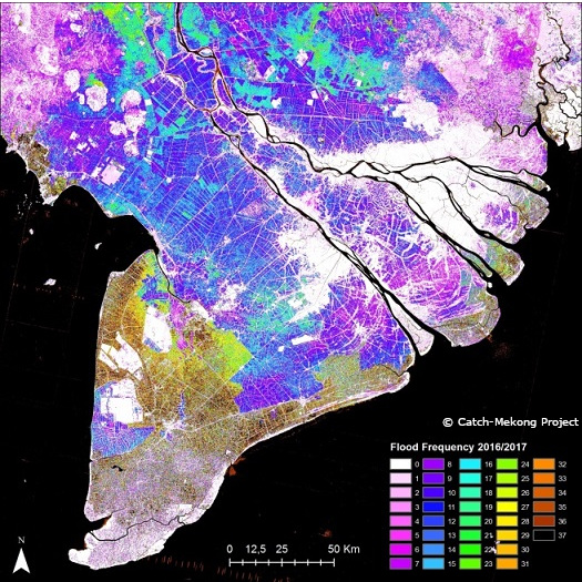
Figure: Flood Frequency 2016/2017 derived with a multi sensor approach. Brownish colors indicate longer water coverage than blue and pink colors.