Scientists from University Wurzburg recently evaluated long-term coastal morphological changes for the entire Mekong Delta in Vietnam. On the basis of SPOT-5 satellite images from 2003 and Sentinel-2 data from 2017, shoreline erosion and land loss as well as accretion processes through sedimentation were quantified every 500m for the entire coastline of the Delta.
As can be seen from the figure, particularly along the south eastern and south western coastline of Ca Mau province erosion rates are very high resulting in land losses of up to 750 meters within the last 15 years.
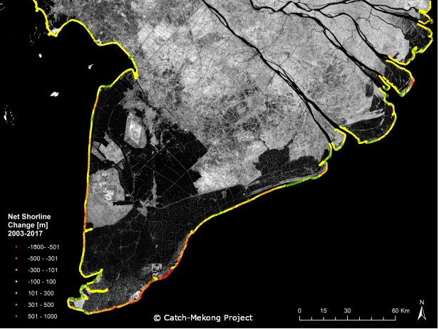
Figure 1: Net shoreline change in [m] between 2003 and 2017 derived from remote sensing data