The European Copernicus Mission provides free satellite data for earth observation mapping and monitoring. DLR used all available Sentinel 2 satellite data of 2016 to derive 20 LULC types for the Mekong Delta region.
Phenological metrics and seasonal parameters describe the course of vegetation growth, which are then classified.
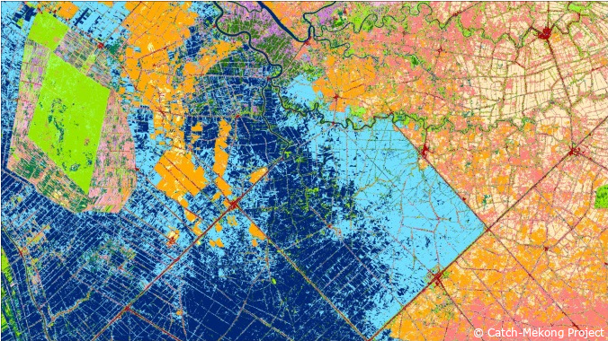
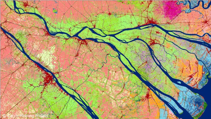
Figure: Two subsets of the Mekong Delta Land Use Map 2016 derived from high resolution Sentinel-2 time series data