For the set-up of hydromorphological numerical models of the Mekong River, datasets of hydrological parameters (discharge, water level) and topography/bathymetry (see Figure 1) have been collected, processed and analyzed by the Ludwig-Franzius-Institute (LuFI).
Existing datasets by German and Vietnamese project partners were therefore supplemented by available datasets by the Mekong River Commission (MRC). The numerical models, which will focus on a river section of approximately 20 km upstream of My Thuan Bridge, are based on the software tool Delft3D. Additional datasets for the calibration and validation of the numerical models will be collected during two in-situ campaigns, which are scheduled for spring and autumn 2018.
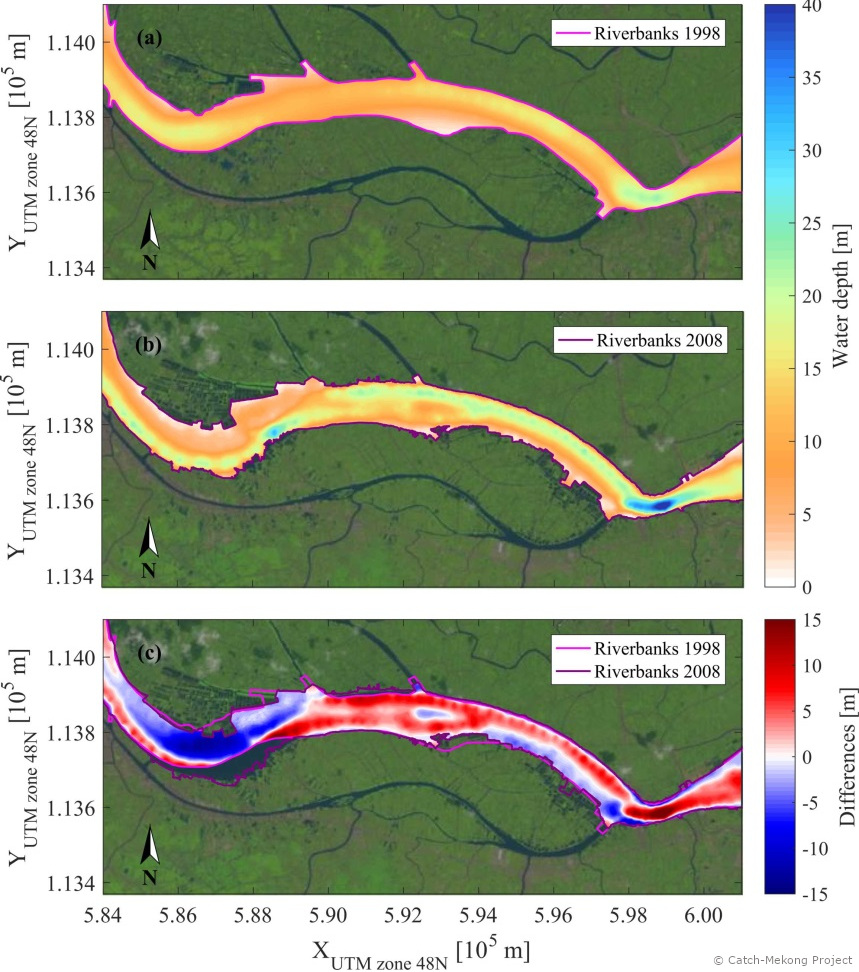
Figure: Bathymetric evolution near My Thuan Bridge. (a) Bathymetry 1998, (b) bathymetry 2008, (c) bathymetric differences between 1998 and 2008. Landsat images show the river course for January 9th, 1998, respectively February 8th, 2008. Source of bathymetric datasets: Mekong River Commission.